|
|
|
|
|
|
 |
 |
|||||
|
|
|
|
|
|
|
|
 Encyklopedia: Basic information Folklore festivals Festivals abroad Ensembles and groups Regional associations Personalities Magazine Folklore Searching Calendar: Folklore events Festivals Abroad: Calendar C.I.O.F.F. Calendar I.O.V. Festivals abroad Offers from abroad Offers abroad Youth exchanges Circles Half-circles Public: Authorities of The FoS ČR Novelties, news,... Archive 2002 Archive 2001 Basic dokuments Contracts Subsidies supplied Browsing articles Address book: Secretariat of The FoS ČR Leaders of ensembles Directors of festivals Representatives of regions Services: For registered users
|
Řeka [ Village or Town/City ] Řeka village originated with an outbreak of fire in the surrounding villages of Smilovice and Guty. The first written reference to it dates from 1644. Řeka is a typical mountain village breaking into the valley of local Beskydy among Gutský, Ropice, Ropička hills and mainly Godula hill from which a famous green sandstone is quarried.
The village is so deeply set in Moravian-Silesian Beskydy it is said that at Řeka you can look only into the sky. The average altitude of Řeka is 420m, the highest point - Ropice hill - is 1,082m high. The Řeka river flows through the village continuing into the Ropičanka river that discharges into the Olše river. The cadastre of Řeka extents to 1,348 hectares altogether and the whole village formed a part of the Beskydy Protected Landscape Area since 1973. The village has very favourable countryside and climatic conditions for recreation both in summer and winter seasons. It forms a distinctive centre of the tourist industry. Plní funkci základního stupně územní samosprávy a v různé míře je také vykonavatelem státní správy. PŮSOBÍ NA KATASTRÁLNÍM ÚZEMÍ:NEXT LINKS
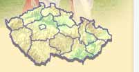
LOCATION
THERE ARE ABOUT VILLAGE OR TOWN/CITY
INFORMATION: http://obecreka.cz Type: Village or Town/City LAST MODIFY: Šormová Helena (INFOSYSTEM s.r.o.) org. 56, 15.11.2021 v 18:56 hodin součást prezentačního a rezervačního systému Doménová koule ® |
|